Silverthorne Seismic, LLC

Geospatial Technologies

Geospatial Technologies: This category explores the revolutionary impact of geospatial technologies on seismic surveys and oil and gas exploration. It covers the latest advancements in geographic information systems (GIS), satellite imagery, GPS, and other spatial data technologies that enhance the precision and efficiency of mapping and analyzing subsurface geological formations. Learn how these technologies contribute to more targeted exploration efforts, reduced operational costs, and improved environmental safety in the energy sector.

Geospatial Reference in Seismic Studies

Leveraging Geospatial Reference in Seismic Studies

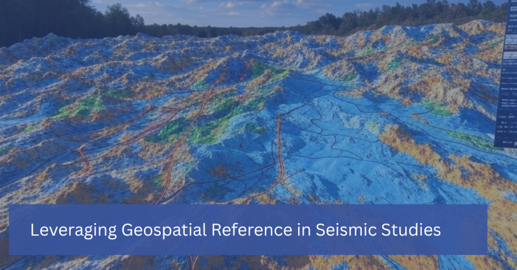
In seismic studies, understanding the precise location of underground structures is just as important as interpreting the data itself. This is where geospatial reference comes into play. Geospatial technology, which incorporates geographic information systems (GIS), remote sensing, and GPS, provides the framework for mapping and analyzing the spatial relationships between geological features. By leveraging geospatial […]

Leveraging Geospatial Reference in Seismic Studies Read More »

What is a Coordinate Reference System

What is a Coordinate Reference System?

What is a Coordinate Reference System (CRS)? Definition:  A spatial reference system (SRS) or coordinate reference system (CRS) is a coordinate-based local, regional or global system used to locate geographical entities. A spatial reference system defines a specific map projection, as well as transformations between different spatial reference systems. Spatial reference systems are defined by

What is a Coordinate Reference System? Read More »

Scroll to Top